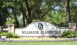
WILLBROOK PLANTATION HISTORY.
The land that was to become Willbrook Plantation was part of a vast land grant from King Charles II to eight British noblemen. The purpose was to develop colonies and generate money for the crown. Earlier settlements in Charleston (Charles Town, 1670) were followed by plantations on the Waccamaw Neck.
In 1711, John Crofts bought 1,280 acres which became Oatland and Willbrook Plantations. Crofts sold it to William Branford who split it into: 640 acres (Oatland) for his daughter Martha and 640 acres (Willbrook) for his son, William. Over the next 200 years this land, from the Waccamaw River to the Atlantic Ocean, was bought, sold or inherited numerous times. Indigo was cultivated on the plantation in early colonial days, but rice was the cash crop and created the wealth of the Low Country.
By 1750, Oatland and Willbrook were owned in partnership by Samuel Allston and Benjamin Marion, brother of Frances Marion, the “Swamp Fox,” of Revolutionary War fame. Willbrook was sold again in 1770 and 1798. In 1804, John Hyrne Tucker, who also owned Litchfield Plantation, bought Willbrook. He eventually sold Willbrook to L. C. Lachicotte. His brother Clarence was the last to live in the two story house built in 1895. This house, in which the chimney still stands near the 5th fairway, is on the same site as the original plantation house. The plantation barns and warehouses were along Oatland Creek which is at the end of Heston Point Road.
In 1860, rice production was at 168,950 pounds on approximately 636 acres. There were 630 slaves at the time. The transformation of vast cypress swamps to tillable land was a monumental task and removing trees and ditching and diking was labor intensive. The water control device called a ‘trunk’ was so efficient that today the same system is used in modern operations where the abandoned fields are used for water fowl habitat. This was the Madagascar style of agriculture learned from the slaves that came from that area.
With the beginning of the 20th Century northerners began buying Low Country plantations for hunting preserves and winter retreats. William Ellis, from Pennsylvania, bought Willbrook, Turkey Hill and Oatland Plantations for duck and quail hunting. From this point on all three plantations were sold as one preserve. The southern border of Oatland Plantation bisected Chapman Loop, extending to approximately Willbrook Blvd. The remains of Oatland Plantation Slave Cemetery are on Chapman Loop and contain 38 grave sites. At the intersection of old Kings Road was a one lane sandy stretch that ran east of the cemetery. A Cherokee rose bloomed every spring and it was told that on the first full moon night after the rose bloomed, you could see the spirits of those buried in the cemetery, dancing and rejoicing in the roadway because the cold winds were not to return for many months and living would be easier in the days to come.
In 1978, a canoe was noted lodged in a bank of Oatland creek at the Waccamaw River. The S.C. Dept. of underwater Archeology was contacted and removed the canoe which was still attached to the stump of the tree that it was being carved from, and was determined to be the only example of colonial canoe construction in the USA. It is now a permanent display in the S.C. State Museum in Columbia, S.C.
The land between today’s Willbrook Blvd. and Sandy Island Road was Turkey Hill Plantation. The partnership owners of the property continued to change over the years and in 1984 Litchfield-By-The-Sea became the current owners.
The land no longer boasts the cash crops of rice and indigo, but the colonial heritage remains. We have a cemetery that is sacred to the memory of the 38 slaves who were buried there before Freedom Day. The sand ridges and canals along the rice fields echo bygone days. Our live oaks are witness to history, nature and the coming and going of the waters.
Adapted from: Suzanne C. Linder& Martha Leslie Thacker, Historical Atlas of the Rice Plantations of Georgetown County and the Santee River (Columbia South Carolina Department of Archives and History. 2001)
George C. Rogers, Jr., The History of Georgetown County, South Carolina (Columbia, SC: University of South Carolina Press, 1270)
Michael Trinkley, Editor Archaeological and Historical Examinations of Three Eighteenth and Nineteenth Century Rice Plantations on the Waccamaw Neck, Chicora Foundation, P.O. Box 8664, 861 Arbutus Dr. Columbia, SC 29202, 803-787-6910, 1993. (This was the Archaeological study done on the Willbrook property before it was developed.)